Machines
Induced Seismic Monitoring Augmented With Various Multi-Type Sensors Questions the Default Arrangement
As wastewater injection triggers tremors across oil country, a new patent tries to pinpoint underground fractures before regulators turn off the taps.

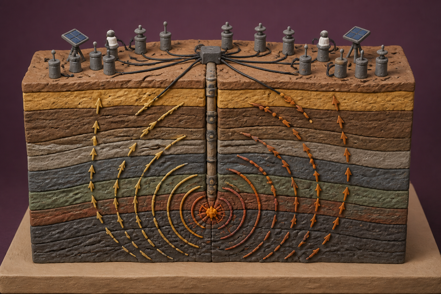
What changes in this design
Monitoring underground tremors typically relies on seismic detectors that register earth movements. A person would reasonably assume that tracking underground shaking only requires listening to vibrations through dedicated seismic tools.
This approach installs both vibration detectors and non-seismic sensors across the wellsite. Rather than relying on vibration data by itself, it lines up the timing between all different measurements to locate underground tremor points.
Pairing vibration readings with other wellsite measurements provides an alternative way to locate where underground tremors originate. Coordinating diverse sensor streams into a unified timeline directly shapes how underground maps are produced.
Two billion gallons a day
Between 1973 and 2008, the central and eastern United States averaged roughly twenty-five earthquakes of magnitude 3.0 or greater each year. By 2015, that number had surged to 1,010. When I looked at the historical records from the U.S. Geological Survey, the sheer scale of the shift was startling. The ground had not suddenly turned restless on its own. Energy companies were pumping unprecedented volumes of fluid deep into rock formations. Today, the US EPA tracks roughly 180,000 Class II injection wells across the country. About twenty percent handle wastewater disposal while eighty percent support enhanced oil recovery, collectively injecting more than two billion gallons of oilfield fluids into deep underground formations every single day.
I doubt many people outside the oil patch realize that the shaking rarely comes from the drilling or hydraulic fracturing itself. The deeper hazard lies in wastewater disposal. Pumping millions of barrels of heavy brine deep underground raises pore pressure, lubricating ancient faults that have stayed locked for millennia. When regulatory curtailments took effect in high-risk zones, annual magnitude 3.0+ quakes dropped back to 130 by 2019. But the pressure keeps resurfacing. After twin magnitude 5.4 earthquakes rattled West Texas in 2022, the Railroad Commission of Texas intervened across the Northern Culberson-Reeves, Gardendale, and Stanton Seismic Response Areas. Enforcing strict rules under state administrative code, the regulator ordered disposal volume cuts of up to 68 percent, capping daily targets at 162,000 barrels per day and suspending dozens of deep disposal permits indefinitely.
The red light at half a magnitude
When regulators decide that the ground is moving too much, an entire basin can grind to a halt overnight. In the United Kingdom, the government announced an immediate nationwide moratorium on hydraulic fracturing in November 2019. That shutdown followed a magnitude 2.9 seismic event at the Preston New Road site in Lancashire. Under the country's strict traffic light regulatory framework, any tremor reaching magnitude 0.5 required operations to pause immediately. The detail that caught my attention was how strict that threshold was: British regulators concluded that available subsurface monitoring tools could not forecast or mitigate tremors reliably below magnitude 0.5.
For energy producers, losing disposal permits or fracturing licenses is an existential threat. If you cannot manage your wastewater, you cannot pump oil. Over the last decade, service companies have built elaborate hardware setups to prove they can track underground fractures safely. Some deploy radial surface geophone networks across five to fifteen square miles, using passive seismic emission tomography to map fracture geometries without the steep expense of drilling dedicated monitor wells. Others install permanent sensor arrays buried fifty to three hundred feet below the surface across five hundred square miles. Downhole, fiber optic specialists run engineered optical cables down the borehole, achieving a hundredfold boost in signal-to-noise ratios to detect faint acoustic pulses and strain along the pipe.
Listening with more than ears
A newly published patent application, US20260259339A1, titled Induced Seismic Monitoring Augmented With Various Multi-Type Sensors, tries to pull these disparate monitoring approaches together. Instead of relying on a single measurement channel, the application outlines a method that places both seismic and non-seismic sensors across a wellsite. It records different physical data streams simultaneously, synchronizes the incoming measurements, and uses the combined dataset to map subsurface seismic hypocenters with greater spatial precision.
Looking across the filing, our team noticed how much weight it places on time synchronization between dissimilar sensors. Standard geophone setups often struggle with surface ambient noise, while downhole acoustic fibers can miss broader regional dynamics. By fusing seismic shockwaves with synchronized non-seismic physical readings, the system attempts to pinpoint the exact underground origin of a fracture in real time. If an operator knows precisely where a fracture front is advancing, field engineers can throttle injection rates before high-pressure fluid strikes a critical fault zone.
The harder half of the problem
The engineering in the application is neat, but it runs headlong into a stubborn physical barrier. Geophysical modeling published on arXiv shows that fluid-induced pore pressure does not just cause sudden, sharp cracks in rock. A substantial portion of fault displacement takes place as silent, aseismic creep. When pressurized fluids seep into a fault zone, the rock faces begin sliding past one another smoothly and slowly. That motion transfers massive mechanical stresses across the fault without generating the microseismic acoustic waveforms that geophones, accelerometers, or optical fibers are designed to hear.
What we cannot measure easily from the surface is that silent accumulation of stress. By the time a fault slips fast enough to produce a detectable seismic signal, the silent slip has already loaded the surrounding rock to the point of failure. Sensor synchronization and multi-type arrays are valuable tools for mapping known fractures, but I suspect that as long as faults can move in absolute silence, listening harder will never be quite enough to guarantee control.
Sources
Reporting for this piece drew on the published filing and the references below.
- US20260259339A1: Induced Seismic Monitoring Augmented With Various Multi-Type Sensors
- Induced Earthquakes Overview | U.S. Geological Survey
- Seismicity Response | Railroad Commission of Texas
- Government ends support for fracking - GOV.UK
- Class II Oil and Gas Related Injection Wells | US EPA
- Microseismic - FracStar® - Real Time Surface Monitoring | MicroSeismic
- BuriedArray® Data Acquisition Services | MicroSeismic
- Carina® Sensing System: High-Resolution Fiber DAS | Silixa
- A fault slip model to study earthquakes due to pore pressure perturbations | arXiv
The record, briefly. US20260259339A1, “Induced Seismic Monitoring Augmented With Various Multi-Type Sensors” A method for monitoring seismic and microseismic activity in a subsurface positions seismic and non-seismic sensors at a wellsite, measures and synchronizes seismic and non-seismic data, and maps subsurface seismic hypocenters using the synchronized data.
More angles on this
- CPC G01V: Geophysics; gravitational measurements; detecting masses or objects; tagsThe official classification family this record was filed into, published in the USPTO Cooperative Patent Classification scheme.
- CPC E21B: Earth or rock drilling; obtaining oil, gas, water, soluble or meltable materials or a slurry of minerals from wellsThe official classification family this record was filed into, published in the USPTO Cooperative Patent Classification scheme.
- Thermal Imaging Camera Device Makes the Next Move Easier to SeeAnother reading from the neighbouring G01J classification family, measurement of intensity.
- Inside systemAnother reading from the wider G05B classification family, control or regulating systems in general.
- Inside methodsAnother reading in the same Machines category on this site.
Read around this one:Public patent recordUSPTO published figure