Groundwork
Tuning the Flight from the Furrow in an Agricultural Survey System
While patent filings try to stitch ground cameras to scouting drones, field machinery is already killing weeds on contact and cutting chemical sprays by ninety percent.

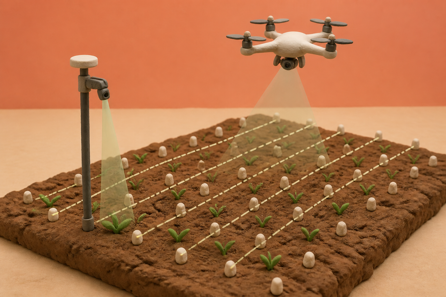
What changes in this design
Surveying a field from above usually assumes that airborne cameras can operate effectively on preset, general configurations without needing specific clues from the soil below.
Instead of flying with fixed settings, this method inspects weed pictures taken on the ground to calculate custom sensing parameters, allowing airborne instruments to capture designated reference points using those tailored values.
Connecting ground-level photography directly to aerial scan configurations shows how different vantage points can cooperate, letting small details on the dirt guide wider measurements from above.
Fifty milliseconds on the boom
The number that caught my attention was fifty milliseconds. That is how quickly a carbon dioxide laser on Carbon Robotics' LaserWeeder fires down at the dirt, pulsing with sub-millimeter accuracy to vaporize an emerging weed before the tractor rolls another inch. The machine relies on onboard supercomputers to target weeds across specialty crop beds without chemical herbicides or prior aerial mapping, cutting weed control costs by up to 80 percent. In conventional row crops, John Deere takes a parallel approach with its See & Spray Ultimate system. A 120-foot boom carrying computer vision cameras and machine learning processors identifies weeds on the fly to spot-spray individual plants, reducing non-residual herbicide volume by an average of 50 percent and up to 77 percent in a single pass. A Swiss manufacturer has built tractor-mounted sprayers that deliver six by six centimeter micro-applications at speeds up to 7.2 kilometers per hour across ten acres every hour, cutting chemical inputs by up to 95 percent across more than a thousand working machines.
None of these machines wait for a map from the sky. They process the soil at twenty frames per second, identify the green leaf against the furrow, and act on the spot. Precision agriculture was originally pitched as a slow, deliberate loop of aerial photography followed by days of office analysis. The machinery builders decided not to wait for that loop to close.
The blur at thirty meters
The trouble with scouting fields from an aircraft has always been optical physics. Drones cover ground fast, but ground sampling distance resolution degrades the moment an altitude ceiling climbs above the crop canopy. I had to check the benchmark numbers twice to believe how quickly aerial vision degrades. In sugar beet trials, standard aerial red-green-blue imagery produced weed detection area-under-the-curve scores of just 0.576. Even after researchers constructed complex nine-channel multispectral tiling frameworks to push that score to 0.782, the airborne view remained vulnerable to simple visual ambiguity.
What we find in the datasets is a fundamental botanical bottleneck. Large-scale benchmarks like the CWD30 dataset, spanning nearly 220,000 images across twenty weed species and ten crop varieties, prove that early growth stages defeat aerial classifiers because young weed shoots look nearly identical to the surrounding crop. When researchers evaluated more than 200,000 images across sixteen weed species in the WeedVision benchmark, mature weeds reached a test mean average precision of 0.904 at over seven frames per second, but recognition accuracy plummeted in early seedling stages before distinct leaf shapes emerged. Paired with strict battery life limits and payload restrictions on small aircraft, flying surveys often turn into an expensive way to collect ambiguous data.
A relay race across the sky
Patent application US20260260485A1 offers a mechanical compromise. Instead of trusting an airborne drone to identify weeds independently, the filing describes a tandem workflow. A ground-level sensor travels the field first, recording reference point positions and taking ground-level weed photographs. Software analyzes those ground images to determine remote sensing parameters, and a flying sensor then captures the marked reference points from the air using those tuned settings.
What we see in the filing is an attempt to rescue the drone by turning the dirt into a calibration bench. The approach echoes earlier multi-tier robotics research that explored how ground rovers and aerial mappers could exchange survey data. Reading the application, I kept wondering why anyone would build a relay race across the sky if the tractor is already on the ground. Yet the filing mirrors where top talent in agricultural sensing is migrating. Dr. Josef Exler, co-inventor on the patent and former head of growth and strategy at a major agrochemical innovation lab, joined Pheno-Inspect as chief commercial officer. That spin-off secured seed backing in 2026 from agricultural equipment and regional development funds to scale cloud drone analytics for plant-by-plant monitoring.
Where the risk actually sits
The patent assumes that ground sensing and aerial scouting are natural partners. In reality, ground rovers and tractors face uneven terrain, mud, and mechanical wear, while drones face strict flight windows and battery drain. Chaining an aerial survey to ground-level calibration does not eliminate these physical constraints; it multiplies them. If the ground camera fails to capture the reference weed or misjudges the parameters, the flight plan inherited by the drone is compromised from the start.
I suspect the real competition is no longer between different algorithms, but between two fundamentally different views of the farm. One view treats data collection as a multi-stage intelligence workflow, where aerial scouts map the field so managers can review heatmaps and plan future chemical applications. The other view treats sensing and eradication as a single instant. If our tools can zap the problem before the tractor finishes its pass, a second pass by air is an expensive chore. When smart booms can eliminate weeds in fifty milliseconds and cut chemical applications by 95 percent, patenting a ground-to-air calibration loop feels less like the future of farming and more like a defense of the flight.
Sources
Reporting for this piece drew on the published filing and the references below.
- Method And System For Collecting Data On A Field Used For Agriculture (US20260260485A1)
- Pheno-Inspect: AI-Powered Field Analysis for Agriculture
- Building an Aerial-Ground Robotics System for Precision Farming: An Adaptable Solution
- WeedMap: A Large-Scale Semantic Weed Mapping Framework Using Aerial Multispectral Imaging and Deep Neural Network for Precision Farming
- Real-time Semantic Segmentation of Crop and Weed for Precision Agriculture Robots Leveraging Background Knowledge in CNNs
- LaserWeeder: AI-Powered Laser Weeding for Specialty Crops
- See & Spray Ultimate Targeted Spraying System
- Ultra-High Precision Agricultural Sprayers
- CWD30: A Comprehensive and Holistic Dataset for Crop Weed Recognition in Precision Agriculture
- WeedVision: Multi-Stage Growth and Classification of Weeds using DETR and RetinaNet for Precision Agriculture
- An Autonomous Hybrid Drone-Rover Vehicle for Weed Removal and Spraying Applications in Agriculture
The record, briefly. US20260260485A1, “Method And System For Collecting Data On A Field Used For Agriculture” A method for collecting agricultural field data combines ground-level and flying remote sensing. Ground-level sensing captures reference point positions and photographs of weeds. Remote sensing parameters are determined from image analysis of the weed photographs, and flying remote sensing captures the reference points using these parameters.
More angles on this
- Targeting the X-Ray Opening Where Recognition Takes OverAnother reading from the same G06V classification family, image or video recognition or understanding.
- Inside bilingual augmented reality lampAnother reading from the same G06V classification family, image or video recognition or understanding.
- CPC G06V: Image or video recognition or understandingThe official classification family this record was filed into, published in the USPTO Cooperative Patent Classification scheme.
- CPC G01S: Radio direction-findingThe official classification family this record was filed into, published in the USPTO Cooperative Patent Classification scheme.
- Reconciling Sensor Posture and Geometry Before Generating Inspection Text CodeAnother reading from the neighbouring G06F classification family, electric digital data processing.
Read around this one:Public patent recordUSPTO published figure